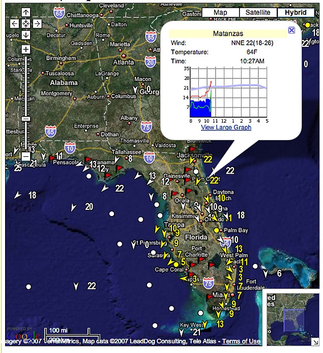
ikitesurf has come up with a new presentation of REALTIME winds embedded on satellite images that will help with weather planning.
The first image is located at:
http://www.ikitesurf.com/windAndWher...ction=Gmap+Obs
Be sure to hit "hybrid" to get the satellite photo.
They have similar coverage for other areas throughout the USA, Caribbean and parts of Canada.
If you sign up for a wireless membership you get all the stations in yellow in addition to the ones in white. Also you have access to valuable historical wind records to help in planning trips and other information.
It's all about wind, sometimes anyway, will you get some? Why not find out.
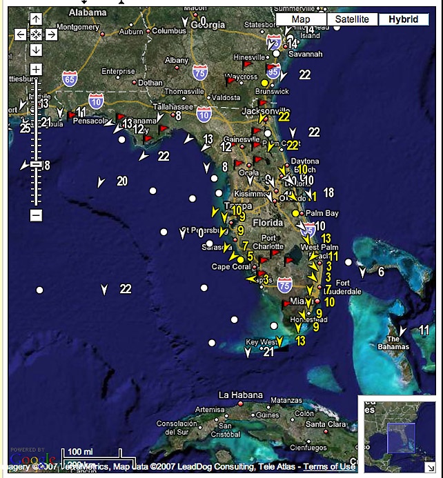
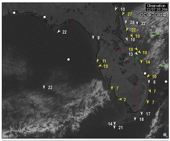
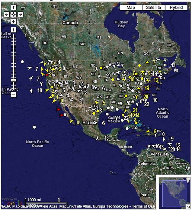
They say they have about 800 stations throughout the USA, Canada and the Caribbean.