Ah, didn't know the Backcountry guys were going to put something together. Their backyard, should be a better way to do it. It really is a pretty easy run, far easier with a kite than on a windsurfer.
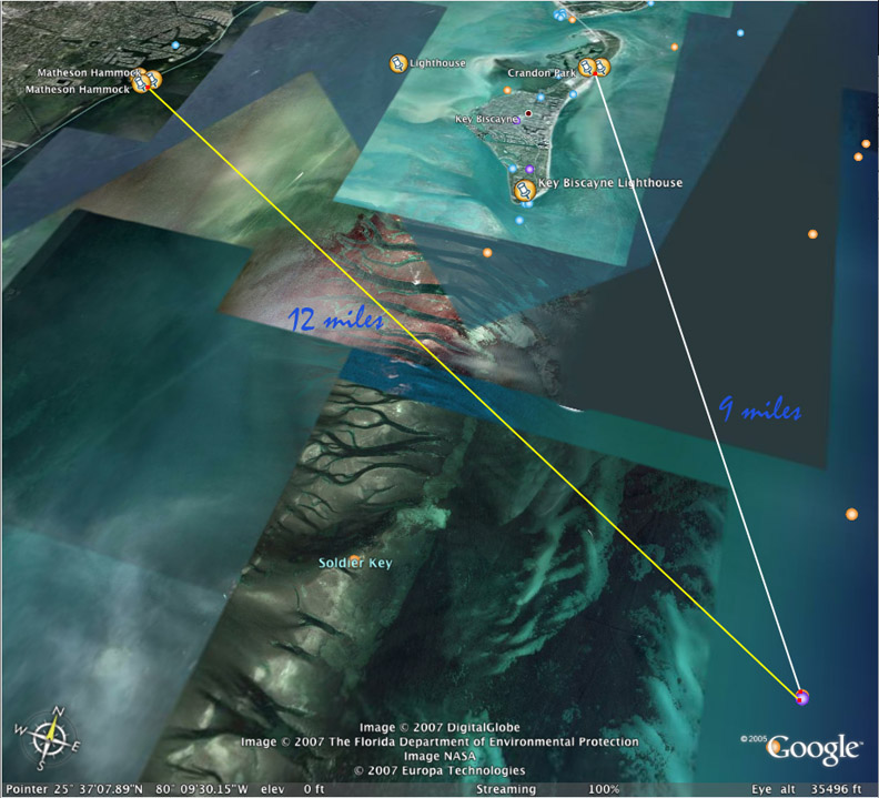
Looking at Google Earth (GE), it is about 9 miles as the crow flies. What wind directions would you run this in? I'll capture and upload the image soon. If the wind is less than ideal, a bit more northerly, it is easy to trend too far westward. What about a two legged race, Crandon-Fowey-Matheson? It works out to around 21 miles as the crow flies and might be more forgiving of a more northerly than ideal wind like from the NE. Here's a question, would we be able readily see marks to steer on for the return trip? Or would we have to steer on the Cape Florida Lighthouse or maybe a large house in Stiltsville until the Matheson mark showed up.
What wind directions would you try to run a point to point race in (Crandon to Fowey alone)? Do you think it would work, leeway and set considered with an easterly wind? The return would be easy enough, getting to Fowey is what I am wondering about.